With the advent of digital information, we have the ability to personalize and track vital information as never before, as well as the ability to store and retrieve vast amounts of information. But storing all this data means there has to be a simple, easy way to manage it, so we can find it when we need it.
Lists, spreadsheets, and databases help, as do shared documents. But managing a large physical space, such as an office building/complex, warehouses, or an airport terminal or hangar, has its own unique set of problems. The ability to manage the many structural assets in a large facility can be difficult – especially if the information is stored in multiple formats and places (such as three-ring binders, spreadsheets, separate software applications, or all of the above).
This data retrieval issue becomes even more pronounced when we need to share our resources with business owners, managers, personnel, vendors and, most importantly, first-responders. No matter how familiar you are with a building – when an incident takes place, those responding to an emergency situation need current, accurate data – and they need it immediately.
One solution is to represent critical building information digitally the same way it’s laid out in the real world: with a map. Software that uses location-based data storage presents an interface that anyone can understand, use, and share quickly.
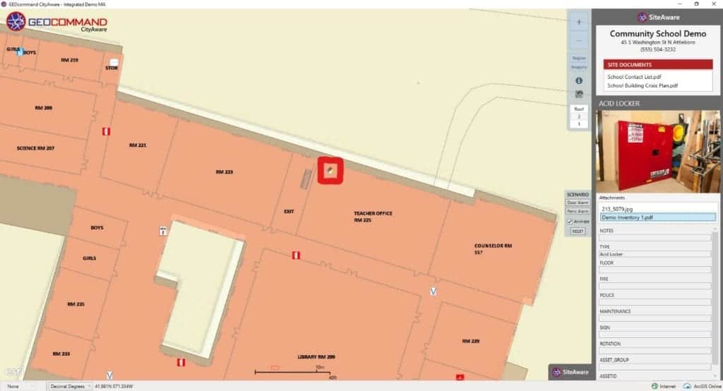
For example, with GEOcommand software (on the image shown below), you can quickly find:
- the date of the last time you checked your camera system
- the location of fire extinguishers and when they were last serviced
- the location of smoke detectors and when they were last checked
- the location of alarm systems, as well as the last time they were tested

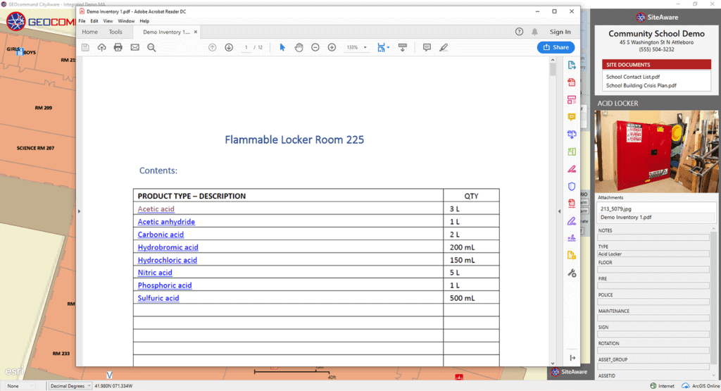
This is all done by clicking on corresponding icons on the map. Inventory lists for hazardous materials, flammable lockers and custodial storage closets are all found by clicking on their corresponding icons.
This basic formula applies to many other applications throughout a facility and includes:
- entrances and exits
- access controls
- security camera feeds
- fire suppression systems
- biometrics
- personnel
- important machines or assets

Placing the right information in the hands of the people who need it most is one of the best ways to reduce foreseeable problems. It also helps reduce mistakes and streamlines processes. And, if the fire or police department ever does need to come to a facility for an incident, they are able to operate with the best possible data. This helps them maximize their response efforts and effectiveness and, most importantly, can help save lives.
Location-based storage software, such as GEOcommand SiteAware, provides state-of-the-art geographic information on a map-based interface. This gives you the ability to manage, maintain and update critical information on a daily basis – for maintenance tracking purposes as well as for sharing with emergency responders if the need arises.
About the Author


